DESCRIPTION OF GEOSTORE V6
About product
Overview
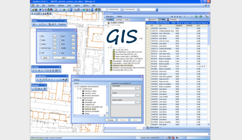
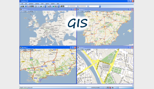
GeoStore® V6 is an advanced GIS system based on Microsoft .NET. It combines the most important functions for creating, updating and managing geographic data with advanced functions of GIS. GeoStore V6 can serve as a powerful graphic editor with a full scale of editing functions common with CAD tools or as an advanced desktop GIS system.
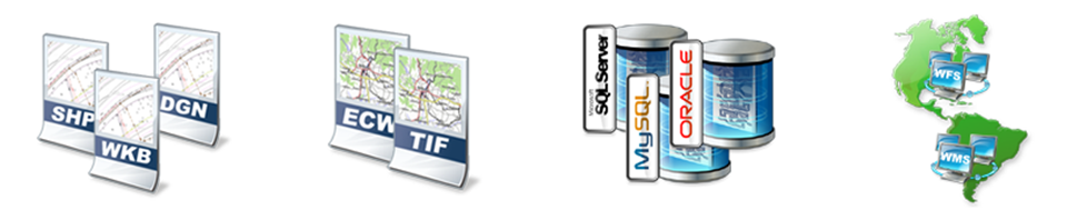
GeoStore® V6 works with file data in common formats DGN, SHP, DXF, and GML. Geographic data can be also read from and stored to SQL databases ORACLE, ORACLE Spatial, MS SQL Server, MySQL and SQLite.

GeoStore® V6 works with SQL database in the mode client/database server or it can also work in the mode client/application server/database server, which enables creating and editing of data by means of internet/intranet connection on remote servers.
GeoStore® V6 is a system based on standards of Open GIS. The native format for data storage to SQL databases is WKB (Well Known Binary) standard according to OGC SFS for SQL 1.1. Reading and storage of geographic data according to GML 1.3 is a matter of course. System integrates functions of WMS client for reading data from internet WMS sources according to standard OGC WMS 1.3.
GeoStore® V6 is a programmable system. Basic methods and data structures of the system core (objects, resp. classes) are public. It provides the highest degree of openness to the users-developers. It can enhance system‘s functionality by writing their own modules and applications developed by standard means of .NET technology.

Versions of the product and requirements
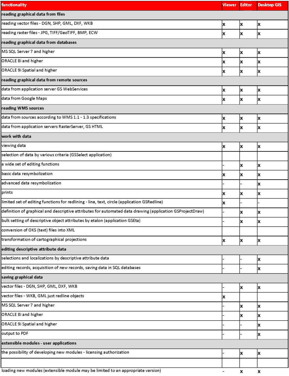
GeoStore V6 Viewer - designed for viewing data from all data sources and redlining
GeoStore V6 Editor - designed for creating and updating data, it does not include advanced GIS functionality
GeoStore V6 Desktop GIS - designed for creating, updating, managing and analyzing GIS data
Functionality
System requirements
Operating system: Microsoft Windows XP/W7/V8 with .NET Framework 2.0 and higher
Hardware requirements
Processor: Intel® Pentium® 4 or AMD Athlon™, memory: at least 256 MB RAM, disk space: 30MB
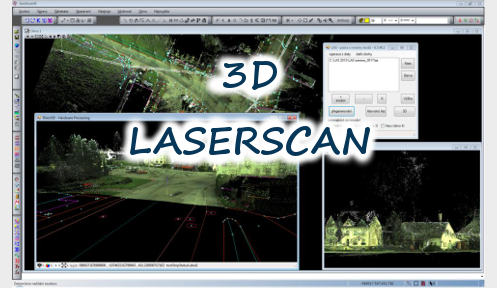
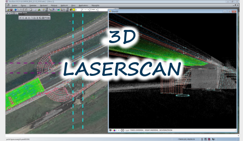
(Recommended configuration for LAS application (Laser Scanning): GeoStore V6 version 6.5.50.8 and higher, DirectX, RAM >2GB)
Data sources and formats
- internal data structures by OGC WKB (Well Known Binary)
- input vector file formats: GML, DGN V7 and V8, SHP, DXF, WKB
- output vector file formats: GML, DGN V7, SHP, WKB, DGN, DXF
- raster formats: CIT, TIFF, Geo TIFF, JPG/JIFF, JPG2000, ECW, BMP, PNM, PNG
- reading and writing to RDBMS ORACLE, MS SQL Server, MySQL and SQLite in WKB format
- reading and writing to ORACLE Spatial®
- reading and writing to RDBMS ORACLE and MS SQL server through Web Services
- data access to WMS (Web Map Service)
- data access to Google Maps through Web Services
- data access to WFS through Web Services
- possibility to export to PDF format
- export from database with possibility to create views for downloading from the database (posibility of downloading data from multiple tables with defined attributes at once)
Extension Modules
Development of New Modules
- open development interface in Microsoft .NET 2.0 technology
- all the essential kernel methods are public and available for the development of user modules, or can be called directly from the command line
- support of development of new modules developed in Visual Studio .NET (i.e. in any language supporting .NET - C#, Visual Basic, J#, C++)
- user developed tools become equivalent part of the system, their public methods may be a part of a batch script
Basic Modules
| Modul | Popis |
|---|---|
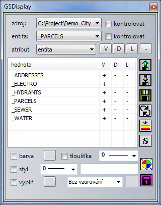
| GSDisplay | Tool for drawing resymbolization by database graphic elements |
| GSSelect | Tool for selection of elements. Simple selections, multiselection, selections by attributes, etc |
| GSMeasure | Tool for measuring lenghts, areas and angles |
| GSEta | Tool for DB table setup and for descriptive attributes of geometric element by its graphic attributes setup (uniform structure) |
| GSModify | Tools for modification of graphical elements |
| GSPanel | Tool for creation of custom toolbars |
| GSProjectDraw | Drawing tool for drawing according to pre-defined conditions |
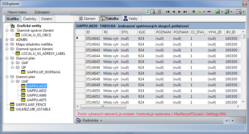
| GSExplorer | Module for management of descriptive data stored in database tables of project GS, management of database structures |
| GSTopoAre | General work with areas, edge identification, identification of centroids inside areas and creation of areas, works on RDBMS and files |
| GSSetOper | Operations with geometric objects, GIS analytical fuctions - general set operations (intersection, difference, union, creation of buffer zones) |
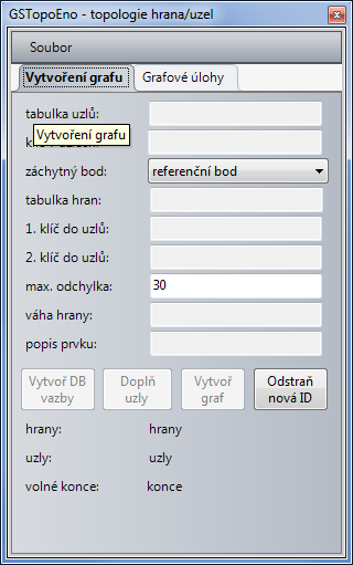
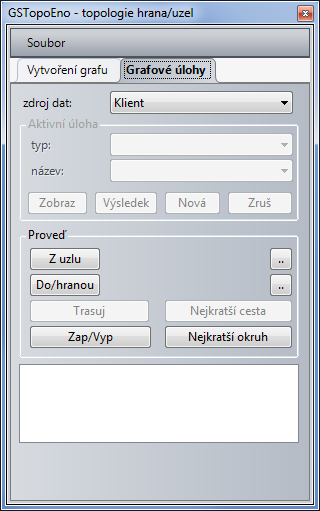
| GSTopoEno | Topological connectivity, derivation of topological relations from geometrical properties of edges and nodes |
| GSFormace | Raster transformation to coordinates by defined points |
| GSAtlas | Creation of advanced print tasks |
Extension Modules
| Module | Description |
|---|---|
| Kladovka | Tools for visualization of map sheet, map sheets of cadastral maps, map sheets of basic maps of Czech republic, decadic scales, display of the map sheet number, display of coordinates in the map sheet corner |
| VFK2WKB | Application for processing ISKN data, conversion of cadastral maps from exchange format VFK to WKB (and further to other formats DGN, GML, etc.) |
| TechLine | Mapsurface content, duplicity of elements, geometric attributes control, element topology repair (loose ends, incorrent elements) |
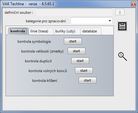
| VAKTechline | Application for data validation before entering into database for VAK data models |
| GeoArchiv | System for management and easy updating of technical maps of large areas; management of information about origin of individual elements. |
| UAP | The application is intended to be used for receiving, acquiring and releasing data of spatial analytical data according to the new Building Act |
| VakVazby | Tool for creating data links in VAK models |
| GSLocalize | Localization using Web Services |
Basic properties
CAD features
User interface
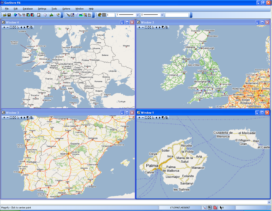
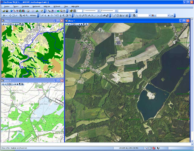
- work with multiple graphical windows simultaneously (up to eight)
- the possibility of setting displayed objects in individual windows
- setting on / off displayed objects by layers and by entities
- configurable placement of dialogues
- option to set keyboard shortcuts for any action
- setting of layers for active and reference mapsurface individually or both at once
- feature to swap the active and reference file, the list of CAD layers is also swapped
- simultaneous displays of data from all data sources:
- vector files
- raster files
- RDBMS
- WMS sources
- data from web services
Basic construction and modification of data
Construction of elements of following types:
- point element, polyline (no limits of the number of vertices, circle, arc, polygon (including complex areas, with holes), the cell – consisting from geometry including unlimited nesting levels, text, spot height, perpendicular
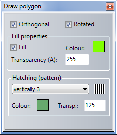
- possibility to define fills, patterns and object transparency
Modification of elements:
- copying, moving, parallel, rotation, resizing (point element and user style), intersection solution, vertex modification, decomposition of combined features, text editing, modification of text attributes, substitution and change of scale of cells, modification of IGDS parameters, tasks of setting text and cell parameters
Setting of drawing and data selection
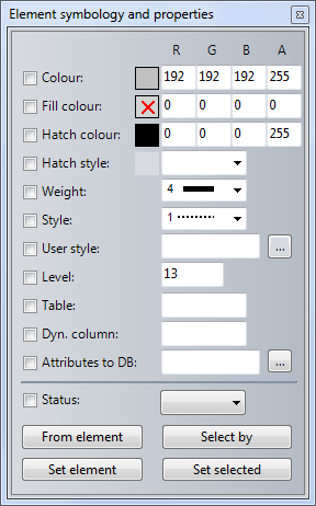
- setting of symbology of objects – color, layer, line thickness, style
- setting of hover type on object – key point, center, reference point, intersection, the nearest point
- selection of objects by fence
- selection of objects by intersecting the line
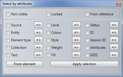
- selection of objects based on attributes – file, table, status, id, element type, session_id
- selection of objects based on symbology – layer, color, style, thickness
- the bulk change of objects symbology
- measuring length, area and angle
- searching and replacing of text based on various search criteria
- the possibility of remembering selection and browsing features, possibility to save the selection as a new file, function selection from the selected elements
Cells and user styles
- work with cells, creation of cells, cell libraries and their maintenance
- the possibility to exchange cells
- feature import cells from the mapsurface to library
- setting and defining user styles, its imports and exports
- setting user styles scale

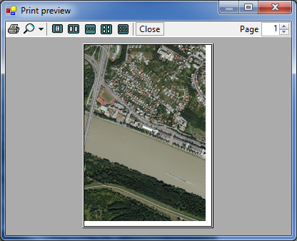
Print sets
- bulk print of map sheets (atlas print)
- definition of parameters – scale, line widht, fence
- output to any system printer in Windows environment
- PDF output
- possibility of raster or vector printing
- possibility to define size and shapes of measured points (square, circle, triangle), possibility to define custom style line lenght for print
- more advance print features (printing of the current viewport, print of one sheet in the given scale, possibility of placing the guide marks for composing sheets of larger sizes

GIS features
- making features from graphical entities assigning graphic table or entity's code
- integrated access to attribute and spatial components of localized information
- reading/writing data from/to RDBMS
- possibility of sharing central libraries of used symbols (cells, user styles)
- work with a seamless map
- localization of objects
- selections based on user-defined criteria (by area or descriptive attributes)
- re-symboling of data based on user-defined criteria
- data archiving
- long transactions support
- editing of descriptive attributes

Administration of GIS projects
- management and maintenance of GIS data model project – tables, views, code lists, creating indexes, triggers
- possibility of creating new objects
- support for creation of localization queries
- support for querying the properties of objects
- support of creation of general links based on spatial component information
- work with code lists
- possibility of extended version for data model administration
- SQL editor for advanced database queries
- possibility of creating and editing of diagram conditions
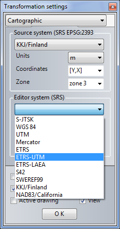
Coordinate systems
- reversible transformation of data between systems
- JTSK
- WGS84
- UTM
- World Mercator
- ETRS
- S42
- SWEREF99
- KKJ/Finland
- NAD83/California
- linear transformation of data
- option of affine transformation for rasters

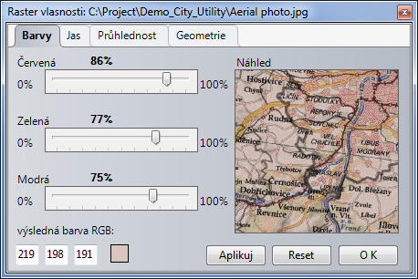
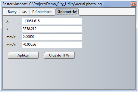
Work with rasters
- loading raster drawings in JPG, JPG2000, TIFF, BMP, ECW, Mr. SID, PNM, PNG
- viewing rasters with the option to change order of display in individual windows
- setting of transparency of layers
- setting of colors and brightness of displayed layers
- setting (modification) of raster geometry
Spatial analyses
- support for creation of areal topology – generating areas with identification
- spatial algebra - set operations with areas (intersection, difference, union)
- creation of enclosing zones (buffers)


Linear topology
- creation and maintenance of linear topology
- search for critical (the shortest) path between two nodes of a graph
- modeling of network status - switching on/off active features (circuit breakers, sections)
- network analysis (find objects that are/are not under voltage)
- analysis of availability (optimization of availability with regards to the dispatchers' center)
Thematization and resymbolization
- resymboling data based on database attributes
- creating thematic maps, including legend
- change of the appearance of data in a view without modification of data in the mapsurface based on the set attributes (module GSDisplay)

Automation of data acquisition
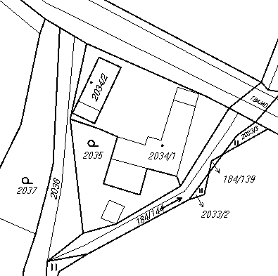
- drawing objects by etalon of the given project (module GSProjectDraw – see picture)
- possibility to change the attributes of selected elements to the selected item, possibility to edit table GS_ETALON in DB or XML file (module GSProjectDraw)
- definition of objects for drawing (symbology and non-graphical attributes)
- drawing LineString - possibility of taking over the parameters from branch to polygon
- loading and saving etalon definition into RDBMS or XML file
- possibility of creating custom toolbars for calling system functions (module GSPanel)

Automation of manual activities
- setting of symbology of drawing tools controlled by parameter setting files
- the possibility of centralization parameters of drawing tools from RDBMS
- support of offline drawing of geometric data for third parties suppliers
- processing commands from the command line
- running batch files (scripts) to automate the processing of larger tasks
- definition and location of the actual stamp
User applications - development of new modules
- open development interface in Microsoft’s .NET 2.0 technology
- all the essential kernel methods are public and available for development of user modules, or can be called directly from the command line
- support of development of new modules developed in Visual Studio .NET (i.e. any language supporting .NET – C#, Visual Basic, J#, C++)
- user-developed tools become equivalent part of a system , public methods may be a part of a batch script
-
applications like:
- import of specific data (Cadaster, Territorially Identification Register)
- topology control and data correctness (TechLine)
- GIS extensions - water mains and communications, electroenergetics, lelecommunications
- analytical tools - line and area topology
- tools for data acquisition
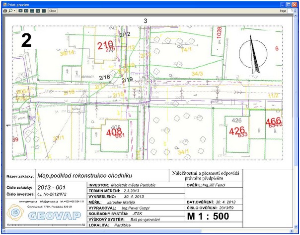
Printing application GSAtlas
- creation of advanced print reports with a stamp, links to other sheets, etc.
- setting of print area for printing map bases
- print of line buildings with possibility to rotate tha map sheet while maintaining the orientation of Noth star
- possibility to print legend into any area, under which does not have to be printed map bases
- using one map sheet layout for various scales with automatic scale recalculation for its display
- possibility to define variables for effective creation of map layouts
- automatic creation of map layout by polygon and subsequent layout editing
- possibility to save map layout into data store for repeated use
Web services
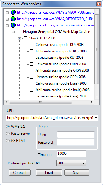
WMS sources
- support of WMS standards by OGC, supported versions 1.0.0, 1.1.0, 1.1.1 and 1.3.0
- setting of WMS sources with choice of data layers
- automatic download of data with change of displaying scale
- setting of transparency, brightness and display order of layers
- combination of various WMS sources in separate windows
- option to redirect to Real Estate Cadaster viewing, Mapy.cz or Google maps after entering point by clicking in the map
- possibility to set quality of downloaded data from WMS, it enables prints in various qualities
- possibility to save and retrieve set WMS layers, while opening the respective dialogue are the saved layers automatically loaded
GSWS
- the possibility of remote access via the Internet / intranet interface to database data stores Oracle and MS-SQL
- updating, management and publication of geographical data on remote servers
- for work with data it is necessary just so that these servers support Web Services
Cloud computing
- the possibility of using the integrated cloud solution
StreetView
- the possibility to view the current location in the map in a web browser in StreetView