GeoStore V6 3D
professional 3D spatial data editor
- data access and editing via internet
- limitless editing possibilities in 3D with support of full drawing in 3D
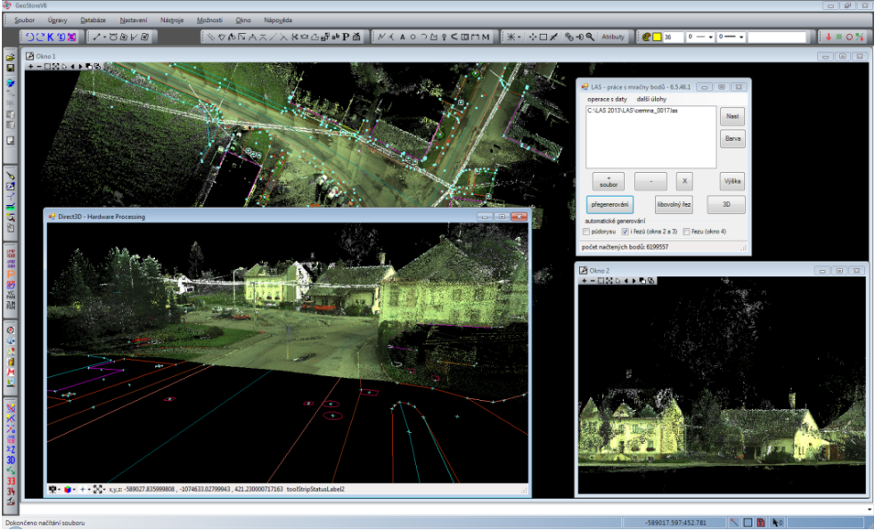
- new approach of display point clouds in LAS application
- seamless map of point clouds at different levels of detail in case of server solution
- display of point clouds in color according to the intensity of the reflection, classification categories or height
- display of dynamic cross sections according to the required level of detail
- creation of overview maps for viewing photographs